
Dublin and nearby Wicklow have some gorgeous walks and hikes if you know where to look! These walks and hikes are all circular and will lead you back to your starting point. If you find this useful, please consider buying me a coffee.
- Two Rock & Three Rock Mountain Loop (Hike)
- Slivethoul and Lugg Forest Trail (Walk)
- Carrickgollagan & Barnaslingan Loop (Walk)
- Maulin Mountain Loop (Hike)
- Lough Bray Loop (Hike)
- Lough Ouler Loop (Tonelagee Mountain) (Hike)
- Blessington Greenway (Walk)
1. Two Rock and Three Rock Mountain Loop
Difficulty: Moderate
Starting Point: Glencullen Adventure Park (GAP)
Length: 8.6KM Elevation: 860m Time: Approx 2 to 2.5 hours Map: Click here
Carpark: Busy – arrive early especially on weekends as it’s a popular Mountain Bike Trail. You must pay €2 when leaving. There are toilets.
Hike: This is a great hike with spectacular views of Dublin Bay and the Wicklow Mountains. It isn’t too difficult but it gets the heart rate up and can be challenging in places. It’s a diverse hike including portions of forest walk, stone uphills and flat board walk. The paths are interwoven with mountain biking trails. Keep an eye on the signposts and it can be mucky/snowy so hiking boots are recommended. We followed a map from All Trails but ended up getting a bit lost.
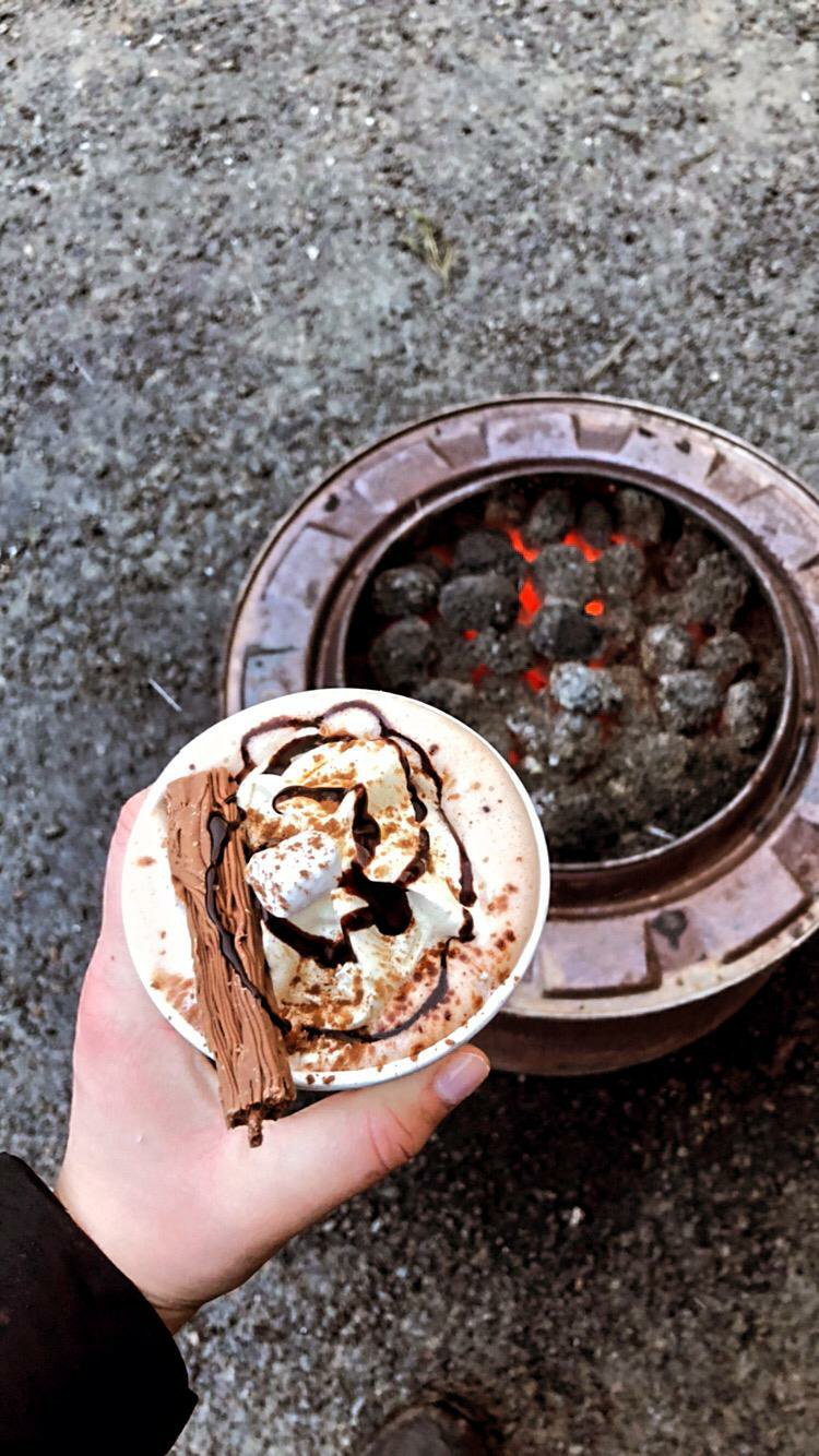
Eat: The GAP has a food area where you can get burgers, chips, hot drinks etc. Warm your hands and relax under the wooden cover with an incredible hot chocolate. Perfect for COVID hiking. Alternatively, the GAP is just a minute from the famous Johnnie Foxes Pub where you can get a well earned dinner. They are operating a takeaway service during Covid.

2. Slievethoul & Lugg Forest Trail (Loop)
Difficulty: Easy
Starting Point: West Dublin here
Length: 9km Elevation: 220m Time: Approx 2 hours
Carpark: There is no carpark but you’ll see cars parked along the side of the road here.
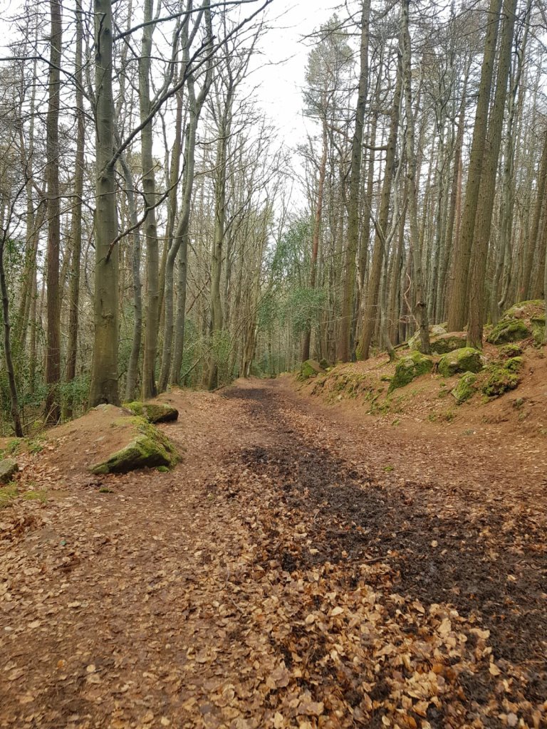
Hike: This is actually two forest walks combined in a figure of eight. It begins with a loop around Saggart Hill (4km) and then you walk a couple of minutes down the road and do a loop of Lugg Forest (5km). If you are only doing one then choose Lugg Forest. Saggart Hill isn’t particularly scenic as many trees have been cut down but it does offer good views over Kildare. Lugg Woods has better views and is a nicer walk overall. It is mucky so boots are recommended.
Eat: Grab a well deserved lunch in Saggart Village afterwards. I recommend the Anvil Restaurant or Carpe Diem.


3. Carrickgollogan & Barnasligan Loop
Difficulty: Easy (the Mountain Access route is a moderate climb uphill)
Starting Point: Here
Length: 5.1km Time: Approx 1.5 hours (including the Mountain Access Route)
Carpark: The carpark is very small. If it’s full you can also park by Barnasligan Forest but this carpark is small too.

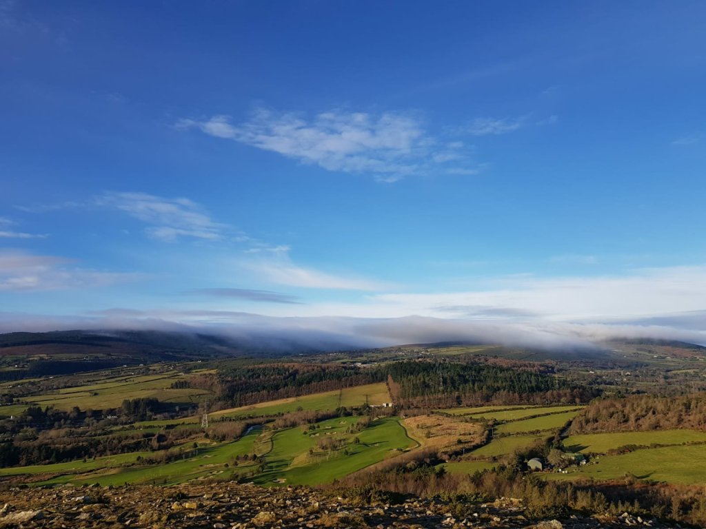
This is a 5.1km loop trail encompassing two main walking routes: Carrickgollogan Lead Mines Way is a loop through the forest which leads you to the old lead mines chimney. On this walk you can also venture uphill along the Mountain Access Route to the top of Carrickgollogan hill and enjoy the incredible views of Dublin and Wicklow. When you complete this loop you can walk less than 5 minutes to Barnaslingan Wood and take the Scalp Lookout Trail which involves a relaxing walk through the forest and a detour out to the Scalp for even more beautiful views. The forest is beautiful and well worth a visit.
Eat: Farmer Browns in Kilternan is just a seven minute drive away or head for the coast to Platform Pizza and Box Burger in Bray (15 mins away).


4. Maulin Mountain Loop

Difficulty: Moderate/Strenuous (suitable for anyone with a reasonable level of fitness.
Starting Point: Crone Woods Carpark
Length: 6km Time: Approx two hours
Carpark: Essential to arrive early as it fills up quickly
A stone’s through from Dublin, the Maulin Mountain Loop is a 6km loop trail which takes you high up the slopes of Maulin Mountain and through forests. The biggest surprise is the view over Powerscourt Waterfall and the Sugarloaf mountain with plenty of other panoramic views along the way. Keep an eye out for the red markers (some can be hard to see!)
Eat: There is a fantastic coffee spot in a converted horsebox in the carpark with a range of hot drinks and snacks (vegan-friendly) called Off The Beaten Truck. Bonus: the business aims to be as sustainable as possible. For something more substantial you could stop off in Enniskerry or Avoca Kilmacagnoue on the way home!

Lough Bray Loop


This is gorgeous loop trail with panoramic views of Lough Bray (upper and lower) and the Glencree valley. Hiking boots are essential as footing is tricky in places and it’s very mucky.
Difficulty: Moderate (hard in parts)
Starting Point: Carpark
Length: 3.5km Time: Approx one hour (including breaks to take in the views)
Carpark: Essential to arrive early (before 9am on weekends). We arrived at 8:30am on Sunday morning and were some of the first people there but the carpark filled up quickly after that.
We did the trail clockwise (i.e. turn left out of the carpark) and had a relatively easy ascent to the ridge along the top of Lough Bray upper. It is a straightforward walk alongside the lake to the incredible viewing point on top of Eagle’s Crag. This viewpoint offers panoramic views across Dublin Bay and the Wicklow Mountains with some great spots to stop for a snack (but make sure you Leave No Trace). You’ll also have great views of Lough Bray Lower as you are standing between the two. The descent from Eagle’s Crag is tricky as it’s very steep and slippy. We used our hands in placed but it was very manageable overall. Then you return to the starting point level with, and alongside, Lough Bray upper.
You can also tackle this hike anti-clockwise (which is what most people seemed to do). Eagle’s Crag looks very intimating from afar (vertical drop) but up close it’s completely doable once you have the right footwear. Keep an eye on where you’re going as it can be easy to go off track but in general the path is well worn.
Eat: If you’re heading that way, stop off at The Timber Trove Cafe above Rathfarnham and try their mixed berry crumble! Great coffee, cakes and gorgeous views.

6. Lough Ouler Loop (Tonelagee)
This is a gorgeous loop with endless views including the magnificent heart-shaped Lough Ouler.
Difficulty: Moderate (strenuous in parts)
Starting Point: Glenmacnass Waterfall Carpark
Length: 7.5km Time: Approx 2.5 – 3 hours
Carpark: Good size but isolated. Arrive early.
Note: Bring spare clothes and download everything you need in advance (no signal in carpark).

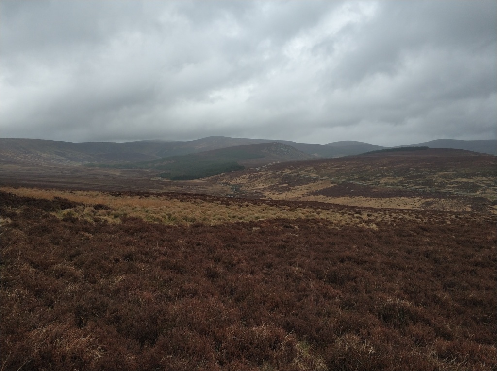
This hike is a trail rather than a path and hiking boots are essential. The ground can be very wet and marshy so be prepared.
After parking, cross the little stream (the rocks are very slippy) – we met a man who fell in twice and had to abandon his hike! Walk alongside the stream until you come to an uphill trail on your left. This trail is hard to see so keep an eye out – it’s more footprints than a trail!
From here it’s a gentle incline and eventually you’ll see Lough Ouler ahead on your right. The path gets steeper as you round the lake and begin climbing up the cliff. Once you reach the top of the steep incline, turn right and you’ll walk across the top of the mountain with stunning views of Lough Ouler and across the Wicklow Mountains.
Remember, you aren’t trying to reach the summit marker. Instead, when you finish the climb turn right and walk towards Stoney Top with Lough Ouler on your right. It’s very dangerous when windy so stay well back from the cliff edge and give it a very wide berth if clouds descend. Before long, you’ll reach a standing stone where you will turn right. When you reach flat ground alongside the lake the path becomes less obvious but it runs very close alongside the lake. Then walk alongside the river which will lead you back to the car park. We lost the trail a few times but managed to get back on track without too much difficulty.
Note: Keep this hike for a good day. It was dangerously windy when we did it and the trail was in bits from all of the rain which made it much more challenging to navigate.
Eat: Head to nearby Heather Restaurant in the town of Laragh. During COVID-19 they’re doing gourmet takeaway. Recommend their seafood chowder and Pesto Sourdough Sandwich (vegan)!


6. The Blessington Greenway

Difficulty: Easy (flat walk)
Starting Point: The Avon (cafe, toilets, food trucks) just outside Blessington Village
Length: 6km each way (this is a linear walk) Time: Approx two hours
Carpark: You need a €2 coin on entry
The Blessington Greenway is an easy trail that takes you from along the shores of Blessington Lakes and through forest and natural woodland. We even saw wild deer! The path is flat all the way and perfect for a family walk. The Greenway finishes at Russborough House and Gardens which are well worth a visit (there are toilets). It’s not too busy and unusualy for a Greenway there are more pedestrians than cyclists. If you would prefer to cycle you can hire a bike at The Avon.
Eat: Check out The Big Blue Bus at The Avon for pizza or else visit the cafe for carrot cake and coffee! There is a coffee cart at Russborough House but no baked goods!


More coming soon! If you found this content useful, please consider buying me a coffee.

Liked & Shared. Thank you. Happy New Year.
LikeLike
Thanks so much, you too 🙂
LikeLiked by 1 person
C’ est un plaisir. Thank you, as well.
LikeLike
Well described hikes and I would certainly head off on one if we return to Ireland. Who doesn’t like a good nosh at a pub 🙂
LikeLiked by 1 person